
Sanjida Suchi
Geospatial Researcher
Course Details
- • Format: Inperson
- • Credits: 3 ECTS
- • Department of Geoinformatics
Leveraging Sentinel-1 SAR Data Portals and Tools for Flood Monitoring
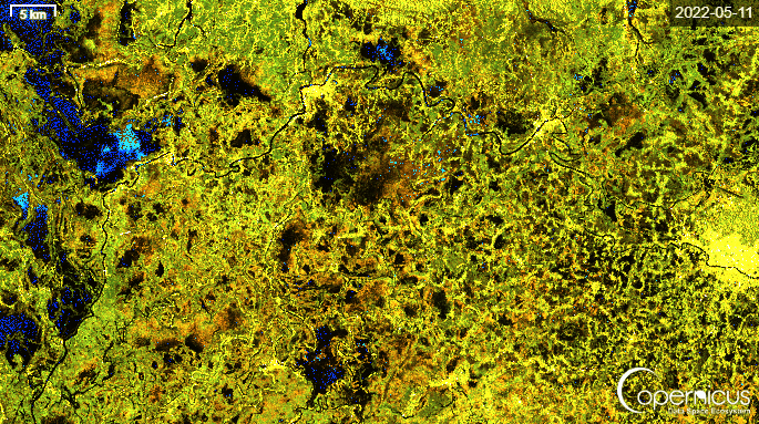
Case Study: 2022 Floods in Sylhet and Sunamganj, Bangladesh
Project Overview
This project explores how Sentinel-1 Synthetic Aperture Radar (SAR) data can be used for flood monitoring and disaster analysis. The study reviews several Earth observation data portals and open-source processing tools used to access and analyze SAR imagery.
A case study of the 2022 monsoon floods in northeastern Bangladesh, particularly the regions of Sylhet and Sunamganj demonstrates how SAR imagery can be used to monitor flood dynamics over time.
The project highlights the advantages of radar-based remote sensing for disaster monitoring, especially in tropical regions where heavy cloud cover often limits optical satellite imagery.
Learning Outcomes
Skills Developed
- • Gained practical experience working with Remote Sensing SAR imagery
- • Developed workflows for flood monitoring using Earth observation data
- • Learned to access and process large satellite datasets through geospatial platforms
- • Applied geospatial analysis techniques within Geoinformatics
- • Created time-series visualizations for environmental change detection
Relevance to My Work
This project strengthened my skills in satellite data analysis, disaster monitoring, and geospatial data processing. It also demonstrated how Earth observation technologies can support disaster risk reduction in climate vulnerable regions. As a researcher working in geoinformatics and remote sensing, these techniques are essential for studying environmental change, climate impacts, and emergency response system driven solutions for sustainable development.