
Sanjida Suchi
Geospatial Researcher
Tools & Technologies
- • Sentinel-1 SAR
- • SNAP Software
- • Snaphu
- • ArcGIS Pro
Image Segmentation
To evaluate and compare the effectiveness of image segmentation techniques in eCognition and ArcGIS Pro using Sentinel-2 imagery, determining which software provides superior image object delineation for specific project requirements.
Goal and Objectives
The primary goal of this project is to analyze and compare image segmentation techniques using eCognition and ArcGIS Pro to assess their effectiveness in geospatial analysis, particularly for detecting ground deformation caused by seismic activities.
- Evaluate the accuracy of segmentation techniques in eCognition and ArcGIS Pro.
- Assess the efficiency and time required for image processing in both software tools.
- Identify the strengths and limitations of each tool in handling complex geospatial data.
- Provide recommendations for selecting appropriate software based on specific project needs.
Key Findings
Image segmentation is a core computer vision task that divides the image into several objects or important parts. The challenge is to reconstruct images by breaking them into simpler parts for better production and understanding. In this report, Sentinel-2 imagery is used to compare the segmentation techniques in eCognition and ArcGIS Pro, focusing on accuracy, efficiency, and object delineation.
Comparison: eCognition vs. ArcGIS Pro
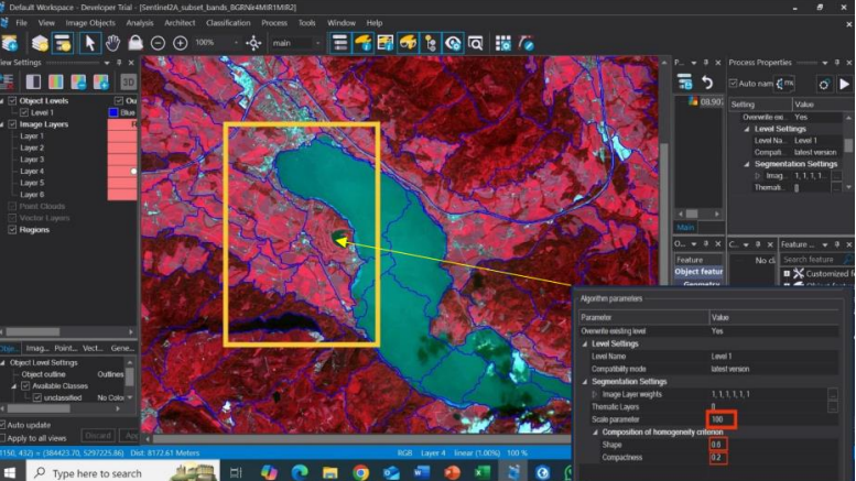
eCognition
Despite parameter adjustments, eCognition sometimes fails to correctly detect certain areas. For instance:
- The lake is significantly over-segmented into multiple regions.
- Borders between segments, especially in hilly areas, are often poorly defined and jagged.
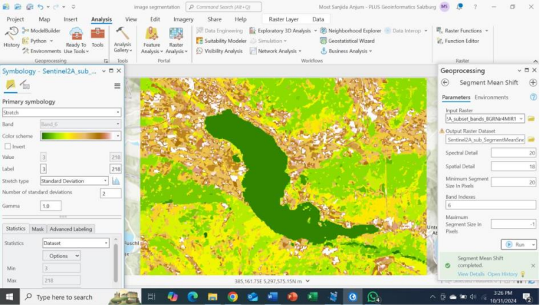
ArcGIS Pro
ArcGIS Pro under-segments in some areas, merging regions that should remain separate. However:
- It can correctly detect areas like the lake with better accuracy.