
Sanjida Suchi
Geospatial Researcher
Course Details
- • Format: Inperson
- • Credits: 3 ECTS
- • Department of Geoinformatics
Local Data Cubes and SDGs – The Role of Local Data Cubes in Advancing Sustainable Development Goals: A Systematic Analysis
Spatial Thinking and Modelling
Course Overview
The Spatial Thinking & Modelling course focused on developing advanced spatial reasoning and analytical skills for addressing complex environmental and societal challenges using geospatial technologies. The course explored how spatial data, Earth observation, and computational models can be used to understand spatial patterns, relationships, and processes across different scales. Emphasis was placed on integrating geospatial data infrastructures with analytical frameworks to support evidence-based decision-making for sustainable development.
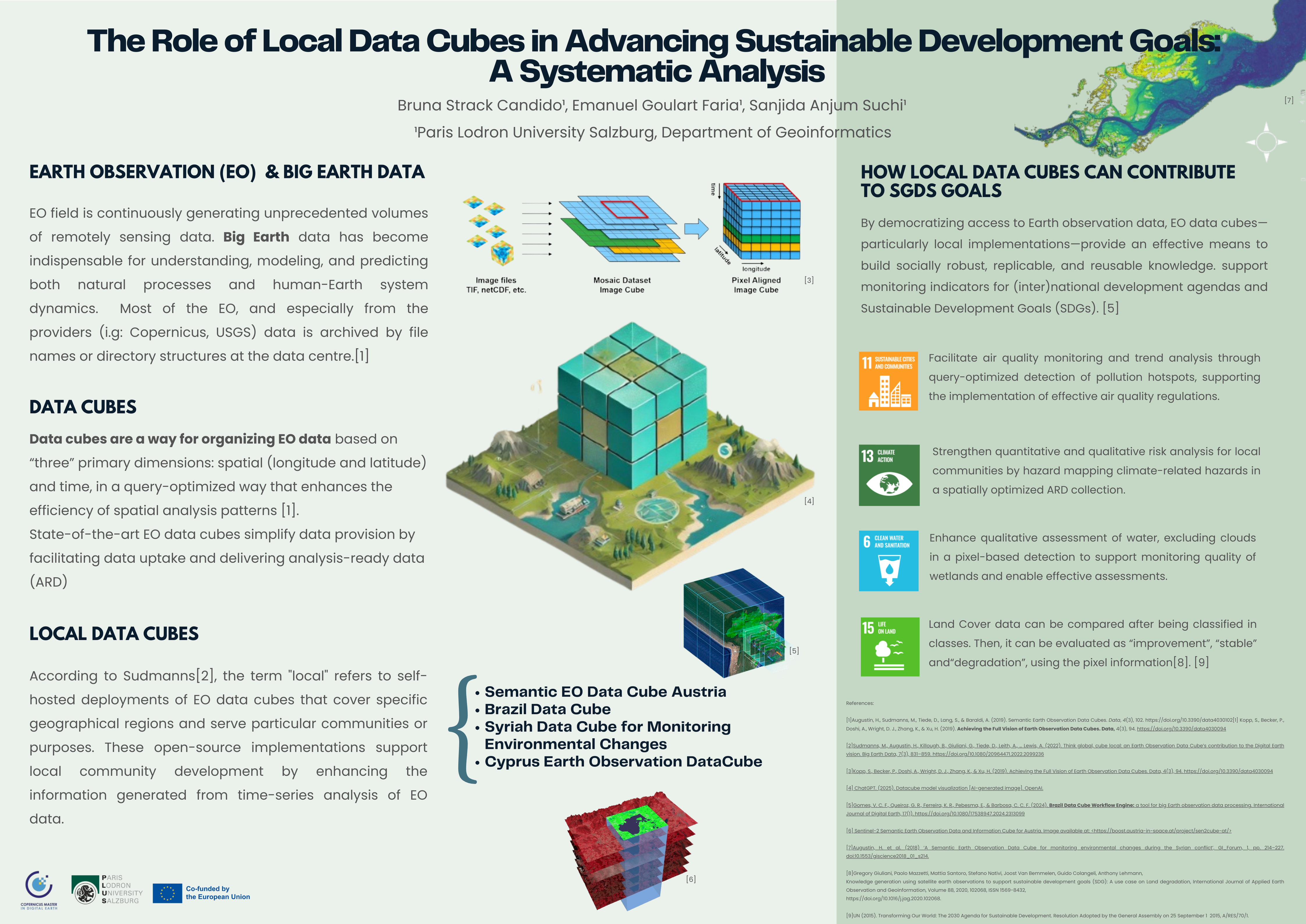
As part of the course, we developed a poster titled “Local Data Cubes and SDGs: The Role of Local Data Cubes in Advancing Sustainable Development Goals : A Systematic Analysis.” The project examined how Local Data Cubes can support monitoring and analysis related to the Sustainable Development Goals (SDGs) defined by the United Nations, highlighting the role of scalable geospatial data infrastructures in sustainable development planning.
Learning Outcomes
Skills Developed
- • Developed spatial thinking and geospatial problem-solving skills
- • Applied spatial modelling techniques to analyze geographic patterns
- • Understood the use of Local Data Cubes for large satellite data analysis
- • Explored geospatial applications for monitoring the Sustainable Development Goals (SDGs) by the United Nations
- • Communicated spatial insights through maps and poster visualization
Relevance to My Work
This course strengthened my ability to apply spatial thinking and geospatial modelling techniques to real-world environmental and sustainability challenges. As a student of Geoinformatics and Remote Sensing, these skills are essential for analyzing complex spatial datasets, supporting climate and environmental research, and developing data-driven solutions for sustainable development.